Stac Pollaidh
Stac Pollaidh (also Stac Polly) is a relatively well-known mountain in the Northwest Highlands of Scotland, located north of Ullapool in the Coigach/Assynt area.
The name is probably derived from Am Stac and the Norse word Pollå (“pool river”).
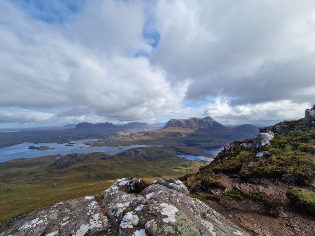
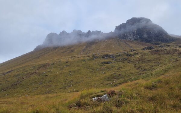
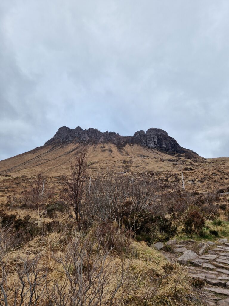
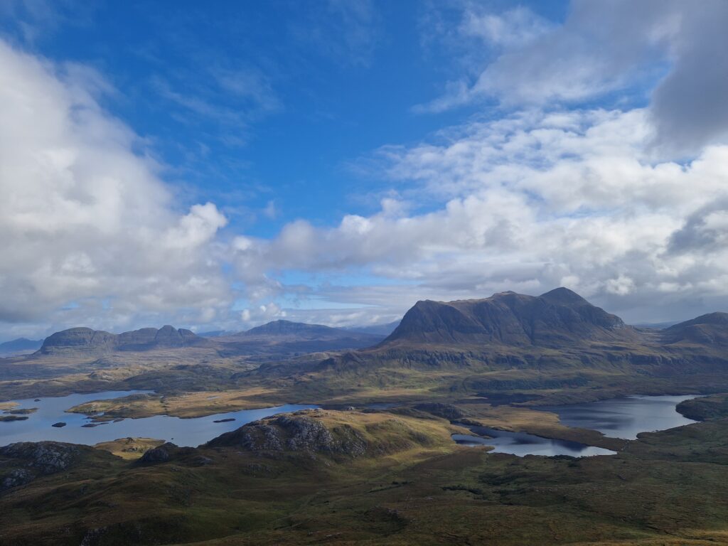
Despite its modest height (south-west summit: 612 m), it rises strikingly from the otherwise rather flat surroundings. The rock consists mainly of reddish/brown sandstone of the Torridonian Supergroup.
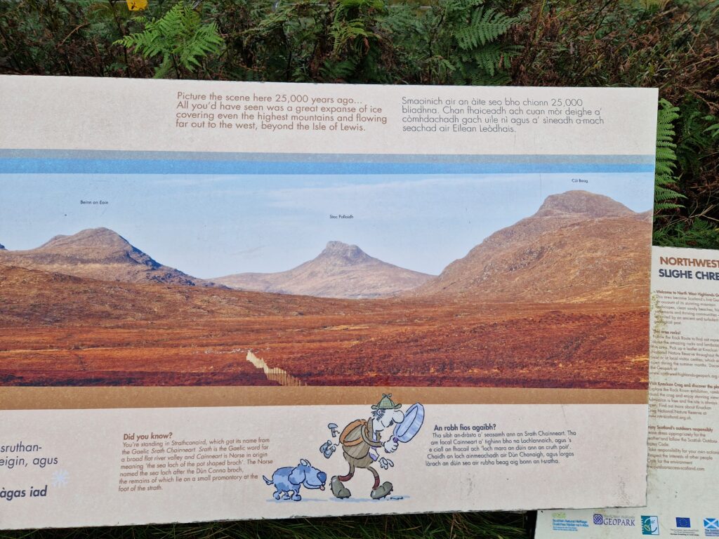
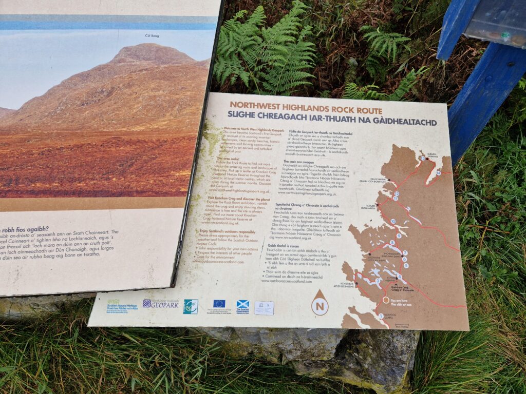
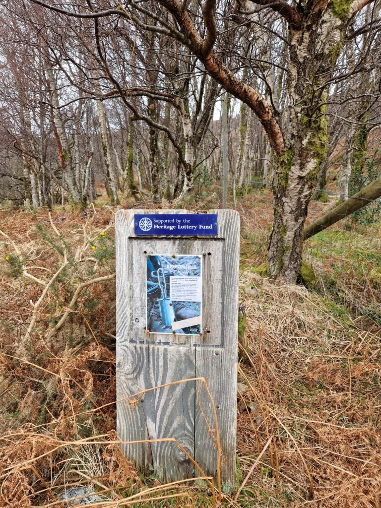
Aside from hikers, the area is likely to be exciting for anyone interested in geology, as you can quite literally see and experience Earth’s history here. If you follow the road (A835, later A837) from Ullapool towards Durness, you enter the North West Highlands Geopark. Here you can take a closer look at the landscape’s special features, join guided tours, or simply read the many information boards.
Stac Pollaidh is not only great for hiking; climbers will also get their money’s worth here. In particular, the “true summit” (western summit) can only be reached with considerable climbing experience and definitely requires a good head for heights.
General Information about the hike
Distance: 4.5 km / 2.75 miles
Time: 2–4 hours (summer conditions)
Ascent: 510 m (summit 612 m)
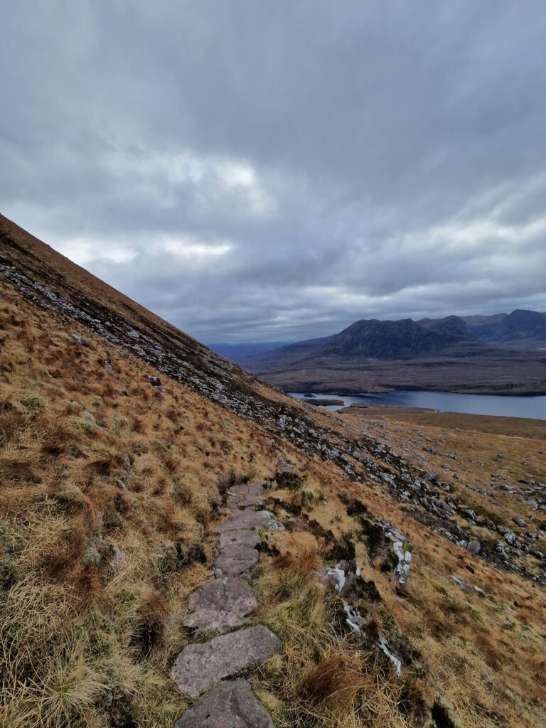
Terrain: A constructed path leads from the car park at Loch Lurgainn on the south-eastern side (right-hand path) up to Stac Pollaidh. The remainder of the circular route is much muddier and subject to erosion (left-hand path). To reach the ridge you must tackle a steep ascent; however, even this does not lead to the true summit of Stac Pollaidh, which is only accessible by climbing.
Getting there: From Ullapool there’s a bus service (route 811, though it runs very irregularly), or you can drive to the car park directly at Stac Pollaidh.
Route – Stac Pollaidh ridge and circuit
Section 1
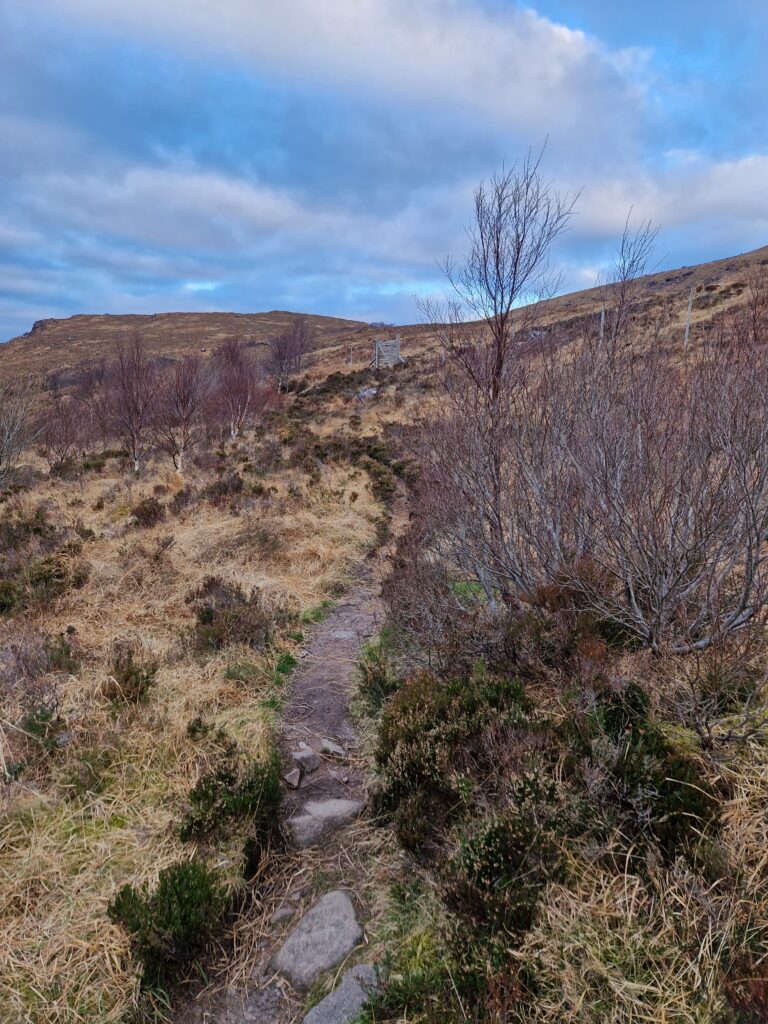
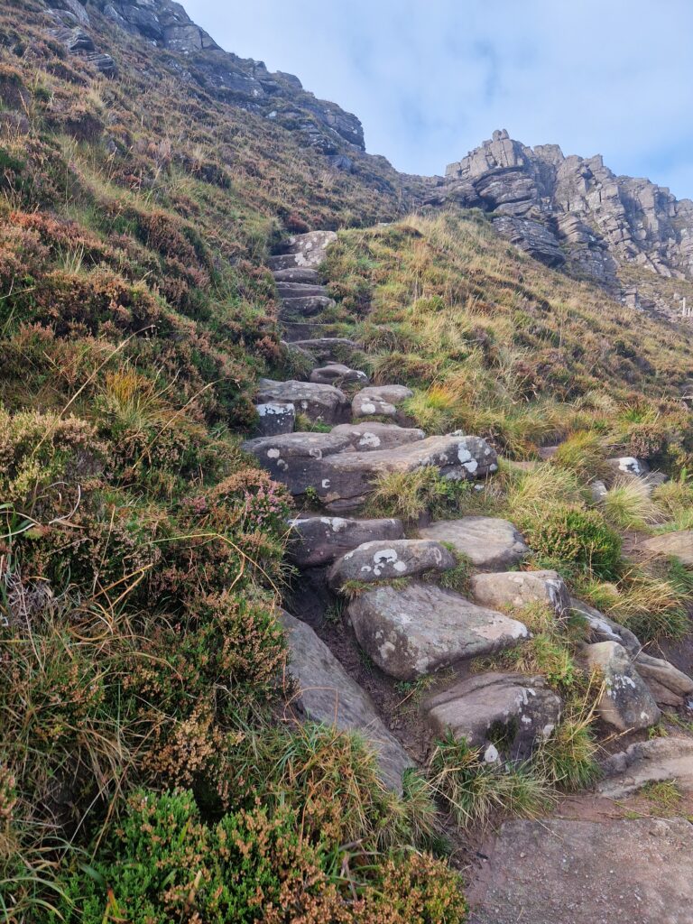
From the small car park below Stac Pollaidh, the route first passes through a wooden gate opposite the parking area onto a built path. It climbs a bit more steeply at first through a small stand of trees. The steps are more or less constructed, but they can be a bit strenuous on the descent. (This part of the path is also walked down again on the descent.)
Section 2
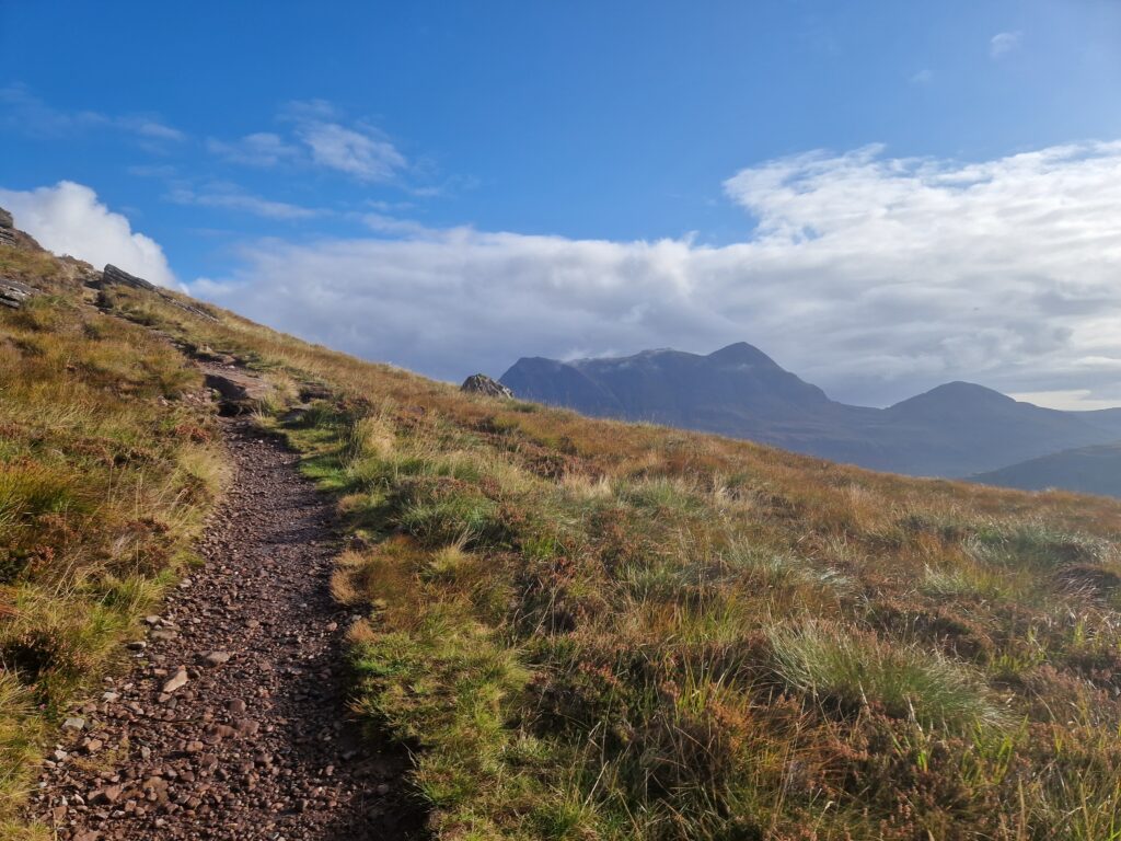
When you emerge from the little woodland, you pass through another gate. Here you can choose whether to circumnavigate Stac Pollaidh clockwise or counter-clockwise. Clockwise, the ascent is less steep and (especially in wet weather) follows ground that tends to be wetter. (When I hike here, I almost always take the counterclockwise ascent because I prefer the views.)
After the first climb you’re on open ground and can choose to go through the right or left gate. As mentioned, the path to the right is much drier and more pleasant for the ascent.
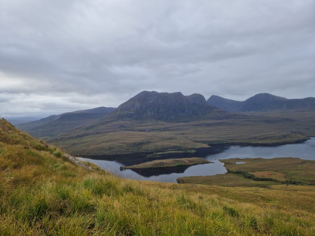
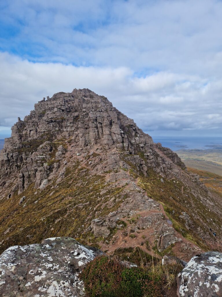
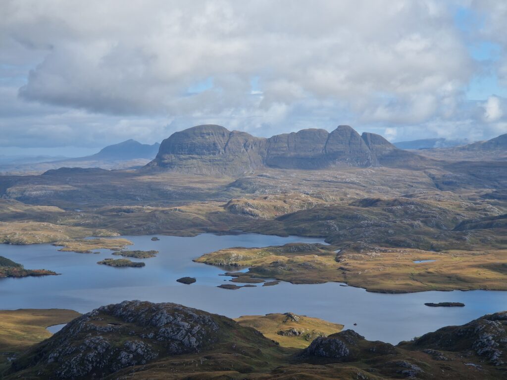
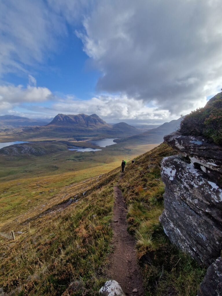
Because the surrounding landscape is relatively flat, you have wonderful views over Assynt/ Coigach. In good weather you can see the Summer Isles, Suilven, Loch Sionascaig, and the Point of Stoer from the mountain’s flank. In my opinion, the view is absolutely worth it.
Section 3 – Counter-Clockwise Walk
The further you follow the path around the mountain’s flank, the more the view opens over Inverpolly Forest.
The path also becomes narrower and steeper until you reach a fork. Here you must decide whether to go right (the lower circuit) or left to continue the ascent towards the ridge.
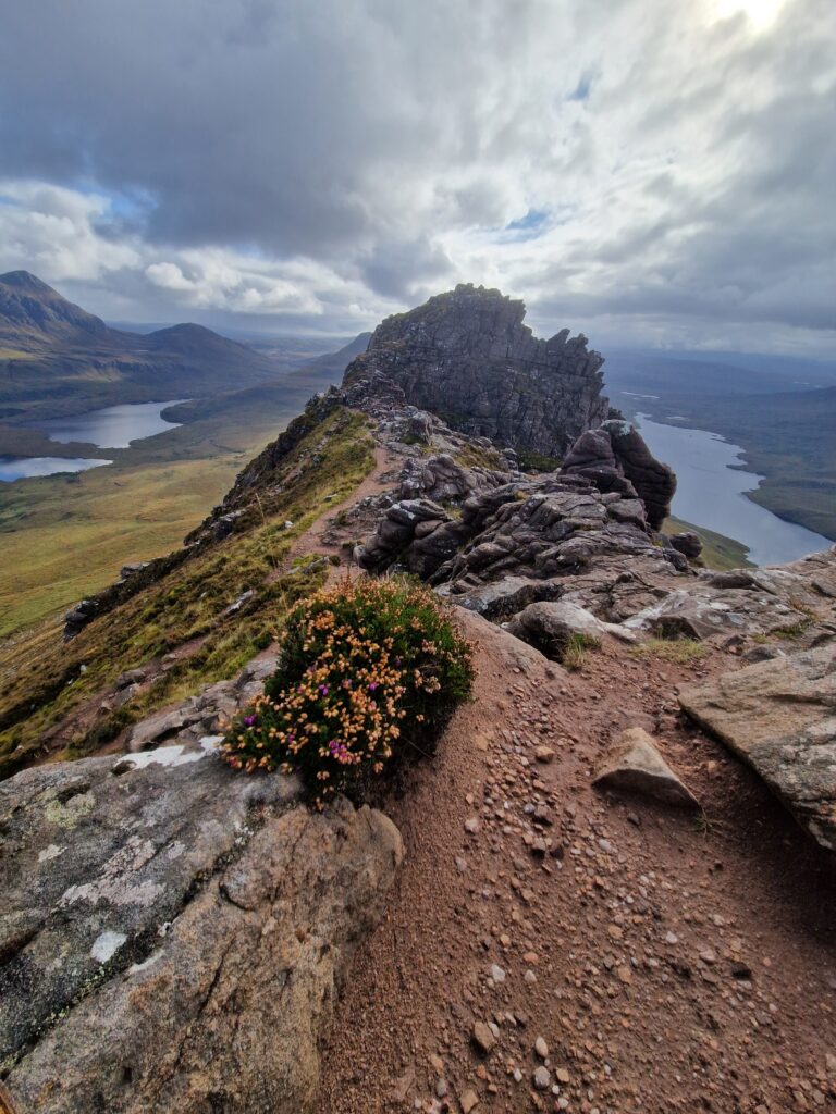
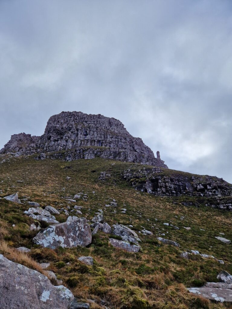
If you choose the left-hand path you should have suitable footwear, be sure-footed, and have at least some tolerance for exposure.
The north-east summit is easily reached with simple scrambling; the south-west summit, however, is only for those with sufficient climbing experience. The south-west summit is also the higher one (612 m) and, together with the Cobbler (Ben Arthur), is considered one of the hardest summits in Scotland to reach.
Section 4
The descent back to the fork follows the same path. Again you can choose either to retrace your steps entirely or to continue on the circular route. However, the ground becomes increasingly muddy and worn along the way.
It’s best to stay on the lower section of the established path rather than trying to pick a seemingly ‚drier‘ one beside it. The ground off to the sides is often just as wet and muddy, and walking there destroys many plants and makes the terrain even more difficult.
Section 5
A few metres before the little woodland (see Section 1), you pass through a wooden gate again, then the circuit rejoins and follows the initial ascent route. You descend the stone steps back to the car park, bringing the ‚Stac Pollaidh circuit‘ to an end.
As mentioned in Section 1, the stone steps can pose some difficulties on the descent, as they are quite narrow and almost always damp/wet. Especially when your feet are tired, take extra care!
Conclusion/ aka my opinion
A wonderful hike with breathtaking views over the surrounding area. Whether in winter or autumn, I think this hike is absolutely worth it!
You can do this tour quite well with a dog, and it’s definitely manageable for beginner hikers. That said, if you or your dog are a bit unsteady or unsure-footed, I recommend not going up onto the ridge and simply following the circuit. Even from there you’ll have spectacular views (as long as the weather cooperates).
midges
Additional information
On Walkhighlands you’ll find a detailed route description and mapping. The site is in English, I find it very helpful – especially for researching/planning my hikes. There’s also a Walkhighlands app available since March 2023, I think. Still, keep in mind that information can become outdated (as I recently experienced on one of my hikes – see here later), and phones can die/break. Although the path on Stac Pollaidh is fairly easy to follow, you should consider carrying up-to-date maps (ideally waterproof) and, if needed, a GPS or other navigation devices (and also be able to use them…).
You should also check the current mountain weather. There are various sites I find good for this, but of course none can offer absolute guarantees. MWIS (make sure you select the correct region!) or Mountain-Forecast – then enter the relevant region or the mountain by name.
Notes: I’ll work on further translations of my walks and travel reports. In the meantime there is another english text about the West Highland Way.